Lost pub · Chalkfoot
The Masons Arms
- Gone
- Closed by the Board, 1918
- There now
- A house
- Address
- Chalkfoot
- Where exactly
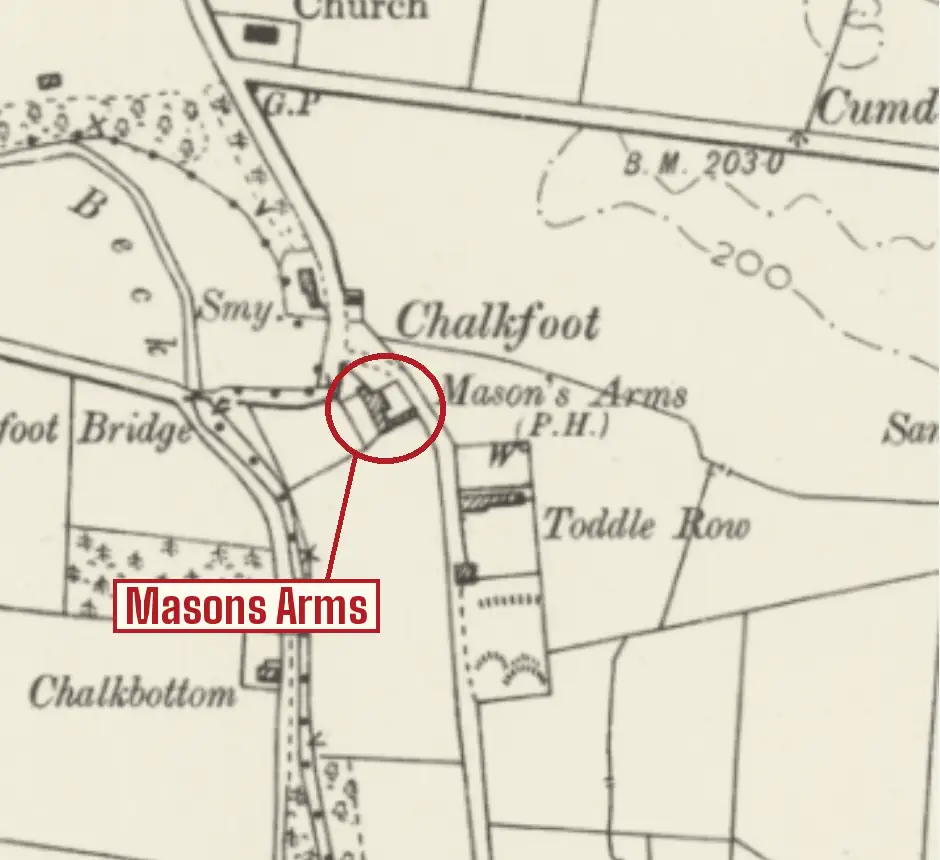
- Placed from the Ordnance Survey grid reference, NY3393148545, in Historic England's gazetteer of the scheme's premises. The six-inch map of about 1900 marks the Mason's Arms (P.H.) here. The building's use in 2018: residential.
At Chalkfoot, on the Chalk Beck west of Dalston, by Chalkfoot Bridge, where the Ordnance Survey's six-inch map of about 1900 marks the Mason's Arms (P.H.) beside the road; it was closed by the Board in 1918. It was trading in July 1916 as the Masons' Arms, Chalkfoot, one of the many small country houses the Board decided it did not need. Robert Longcake held the licence in 1890, and nearly lost it for not turning up.
At the adjourned county sessions that October the superintendent told the bench that Longcake had not applied for it and nobody had come to represent him, at that sitting or the one before, and that he believed he had not appeared the year before either, but had got the licence all the same. If Longcake did not think it worth applying for, the bench should let it lapse. The Excise officer undertook to write to the officer for the district, and the house was still licensed in 1916, so it appears to have survived.
A public house stood at Chalkfoot a century before any of this. Hutchinson's History of Cumberland, printed in 1794, places a Roman barrow on Toddle Hill 'about an hundred yards south of the public-house at Choke-foot', his spelling of Chalkfoot. He does not give its name, so whether it was already the Masons' Arms is not known.
Photograph
Sources
- Historic England, Countering the 'deadliest of foes': public houses of the Central Control Board and the State Management Scheme, 1916-73 (Clare Howard, Research Report 89-2018): Appendix C, gazetteer of scheme premises
- The Cumberland News, 8 July 1916: 'First State tavern: to be opened by Lord Lonsdale', with the list of licensed houses in the Cumberland Ward and Longtown divisions (via newspapers.com)
- Carlisle Patriot, 3 October 1890, p. 2: 'County Police Court', the black list (via British Newspaper Archive)
- Ordnance Survey six-inch map, Cumberland, second edition (about 1900), via the National Library of Scotland
- W. Hutchinson, The History of the County of Cumberland, vol. II (Carlisle: F. Jollie, 1794), p. 444: the public-house at Choke-foot, Dalston parish
Still serving, near where it stood
-
1.6 kmaway
-
2.2 kmaway
-
3.1 kmaway
-
3.4 kmaway